A grading plan is an essential element of a set of construction documents. It’s a drawing that illustrates the topographical layout of a construction site and how the site will be excavated, filled, and graded to prepare it for necessary work to be done.
First, an initial site survey will establish the current topography. This will be represented on a drawing with contour lines and spot elevations.
Using this survey, a civil engineer or architect will assess the property and determine how best to situate the building, locate parking or driveways, and deal with drainage, among other things.
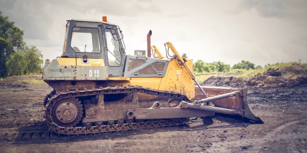
The term grading can also be used as a verb. Grading refers to the process of moving and adjusting the Earth’s surface to the desired elevations and slopes.
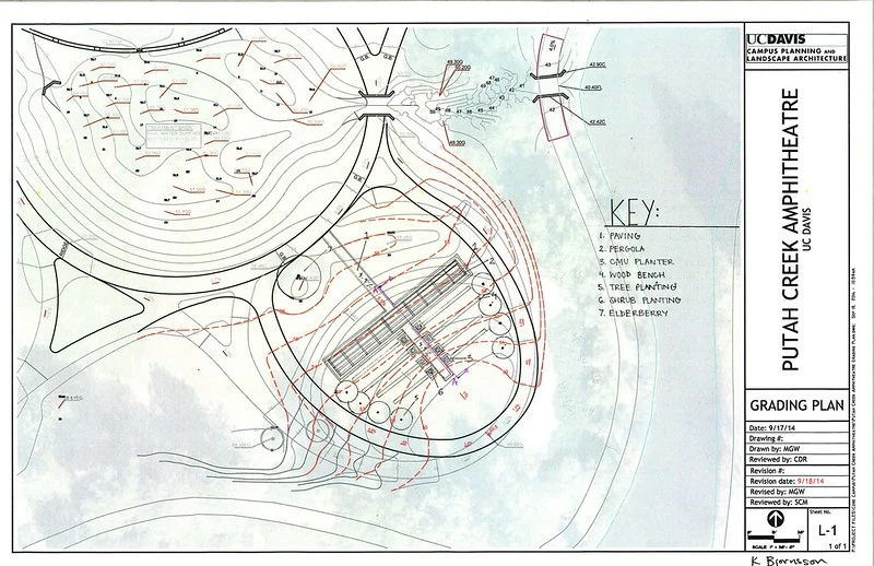
The grading plan has a few goals and should address the following:
- The creation of acceptable slopes at driveways, ramps, sidewalks, and walkways
- The flow of water and runoff on a site, including drainage ditches or retention ponds if needed
- The floor elevation of any new buildings and grading around that building
- Establish where the use of retaining structures are needed when topography cannot be sloped
- Minimize erosion to the site
What should a grading plan include?
A grading plan will include many of the things a site plan will include (read about those here) but what makes them unique are the following:
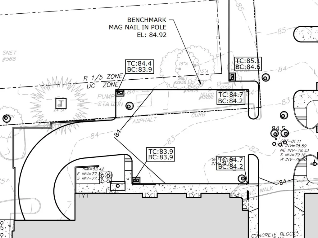
Benchmark(s)
This is a reference point that is marked on a permanent and fixed object whose elevation from an adopted datum is known. This is then used to determine the elevation of other points or objects across a site. New benchmarks are created for a construction site when one isn’t already in place. You’ve probably seen them as you walk around without knowing it. They can be a metal disc or plate or a nail driven into a utility pole or sidewalk.
Original Survey Information
All grading plans are based on an initial site survey. The source of that survey including the surveyor information and the date of the survey should be included on the grading plan.
Contour lines and labels
Often set at 1′ and 5′ intervals, these lines represent the slope of the land. More information on these below.
Spot elevations
Spot elevations indicate a precise measurement of elevation for a specific point. Spot elevations are typically noted on the plan at building doorways and corners, tops of curbs or walls, tops and bottoms of ramps or stairs, and other points of interest on the grading plan. These dimensions are typically indicated to the 100th of an inch.
Miscellaneous items
- The first floor elevation of any new buildings.
- Limit of work
- Existing and proposed culverts or drainage structures
- Swales, ditches or retention areas
- Septic systems and leach fields
What are contour lines?
The most essential part of any grading plan is the contour lines. These lines represent a change in elevation between one another. They are imaginary lines on a map that connect points of equal elevation above a reference point, such as sea level. They represent the shape and slope of the land, and the spacing between the lines indicates the steepness of the terrain.
The contour interval is how much vertical distance occurs between each contour line. For example, a common contour interval is 1 ft. That means that for every line, there’s a change of elevation of one foot. Often every 5th or 10th line will be drawn with a heavier line weight to help the viewer read the drawings.
Contour intervals vary on every contour map. For construction, 1 ft is typical because the work needs to be done in a precise way. A hiking topography map, on the other hand, may have intervals at every 10 ft or 100 ft.
It’s helpful to know how to read patterns in contour lines. When contour lines are spread far apart, the slope is more gradual. Lines closer together indicate a steeper slope. Contour lines in v or u-shapes suggest that there is a linear bump (ridge in topography terms) or swale (valley). For more information on slope and how it affects construction, see this article.
What is finish grade?
Finish grade simply means the final top elevation of a surface. For example, this could be the top elevation of a lawn, sidewalk, patio, or driveway.
What is rough grading?
Rough grading consists of cutting and filling the site per the drawings to get the site mostly finished. There may be some final fine-grading done towards the end of the project before paving and plantings are installed.
What is cut and fill?
Cut and fill is the process of moving earth on a site to prepare it for building or development. The process involves removing soil from high areas (known as “cutting”) and using it to fill in lower areas (known as “filling”) to change the grading of the site. It could be done to level out areas for building pads or parking, to control or alter drainage, and to help prevent erosion.
Ideally, the cut and fill will balance out so that no material must be taken off or imported to the construction site. Moving material on or off a site can add significant costs to construction.